 Time filter & Distance matrix algorithm (Simplified)
This algorithm provides a simplified access to the time-filter endpoint.
Learn more about our distance matrix service
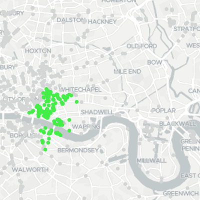
It can be used to get filter a point layer using a time search.
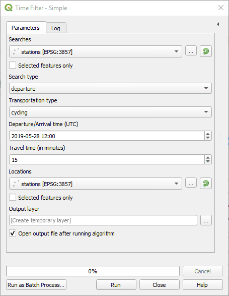
Searches: Choose a point layer from which represents input coordinates.
Search type: Whether the coordinates represent the departure or the arrival points.
Transportation type: Which transportation types to consider.
Departure/Arrival time: The departure or arrival time. Searches are time dependent, as depending on the date/time, public transport or traffic condition may be different.
Time zone: Define the time zone of the departure/arrival time.
Travel time (in minutes): The total duration from arrival to destination.
Locations: The points layer to search from.
Load fares information: Load informations about fares in the resulting attributes.
Output layer: Where to save the output layer. If you leave this empty, the result will be loaded as a temporary layer. It is still possible to save a temporary layer afterwards by right-clicking it in the legend and choosing “make permanent”.
 Time filter & Distance matrix (Advanced)
The parameters match closely the API. They are best documented on the API documentation.
All parameters are expressions, which allow you to freely use the QGIS expression engine to define each of those parameters, which includes access to all features attributes.
In the API, all coordinates are to be provided in the locations parameter, and then searches specify locations ids. As this doesn’t suit well GIS workflows, the algorithm separates source for searches and for location.