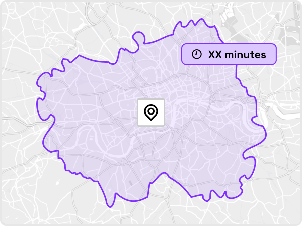
The Isochrone API creates reachable areas based on a maximum travel time. These reachable shapes are sometimes called catchment areas or trade areas, and can be a single polygon or a multi-polygon.
The API supports a range of transport modes including Driving, Public Transport, Walking, and Cycling.
The Isochrone API is a RESTful API, using HTTP requests for access.
https://api.traveltimeapp.com/v4/time-map- GET - for simple requests using basic parameters only
- POST - for more complex requests using advanced parameters
If you already have a TravelTime account then log in to retrieve your access credentials. If you don't have an account, you can sign up for free here.
Quick start guide
A short step-by-step guide to making your first request to the Isochrone API.
Isochrone Playground
An interactive tool for testing the different request parameters, and to help understand the request and response structures.
Endpoint Reference
Full endpoint reference of all request parameters, and example code samples.
The Isochrone API is accessible through any of our supported TravelTime SDKs:


The following usage limits apply to the Isochrone API.
TravelTime Isochrone API supports a maximum travel time of 4 hours.

