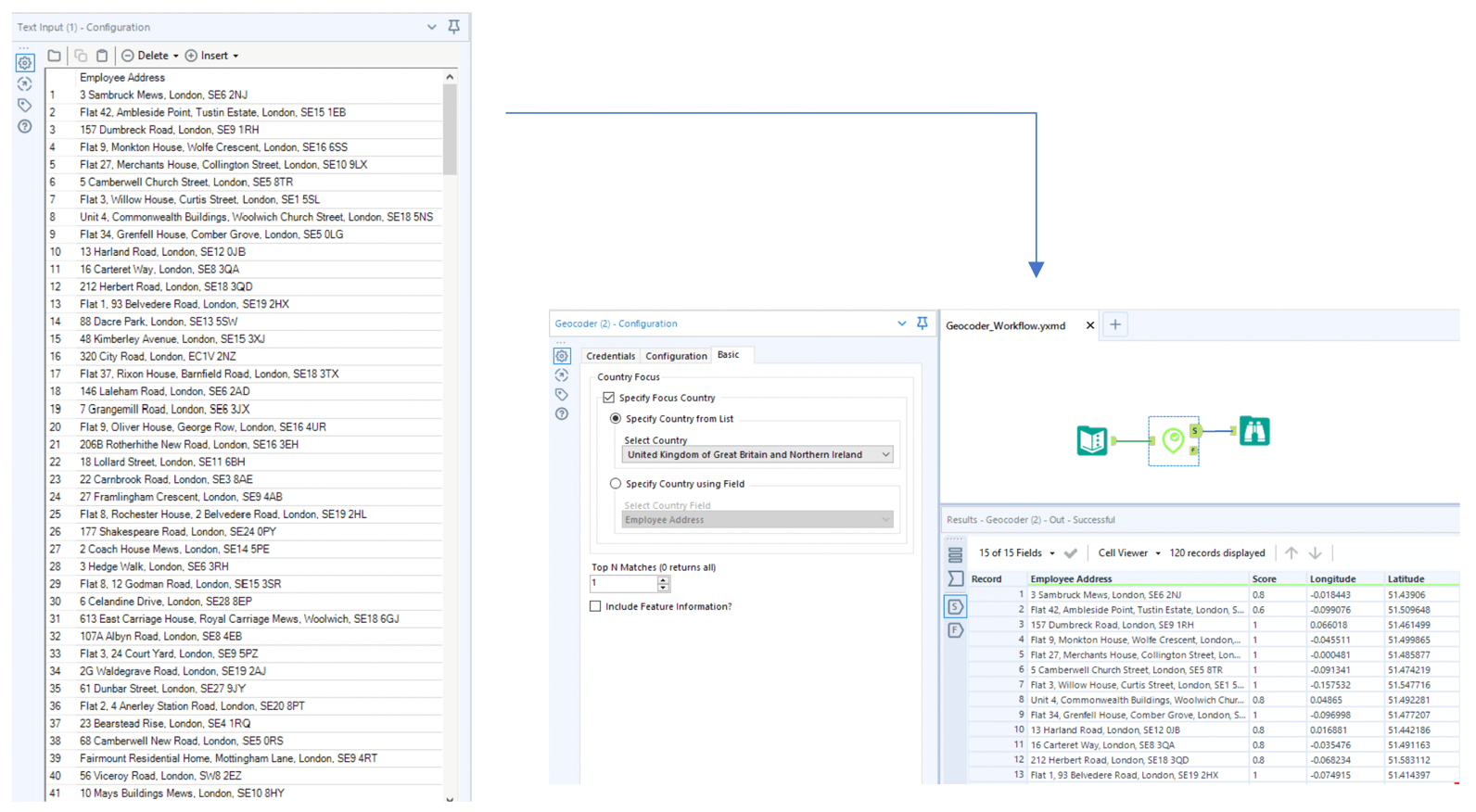
Use Case – converting a list of employee addresses into lat-long coordinates in order to display them on a map
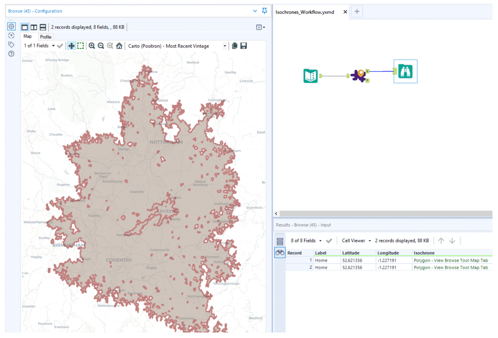
Use Case – calculating the catchment area for a retail store by different methods of transport
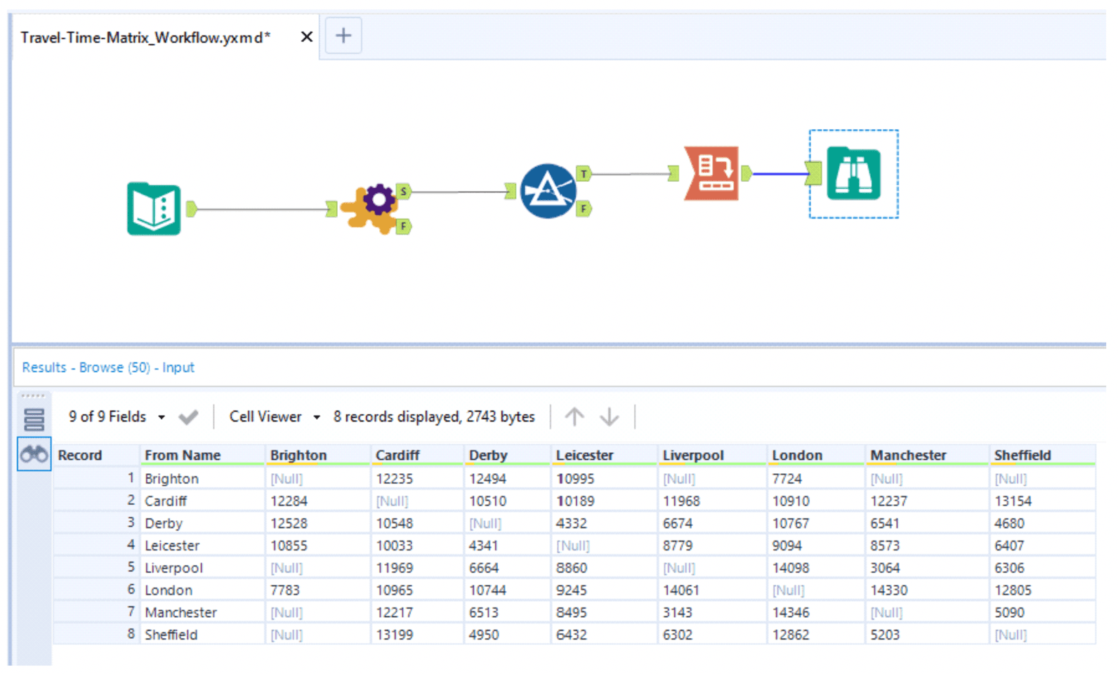
Use Case – calculating the travel times between eight major cities in one go
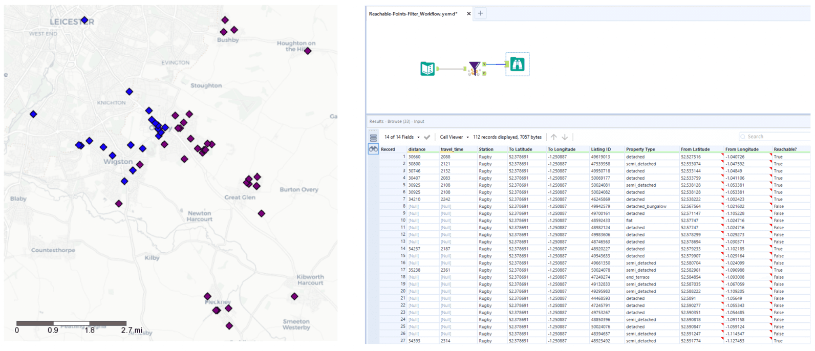
Use Case – filtering a number of real estate properties into those that are reachable within a 45 minute journey time by car from the nearest major station
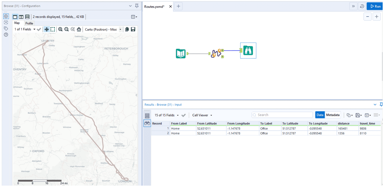
Use Case – visualizing the routes between two points by driving and by public transport