Isochrone maps, also known as travel time polygons or travel time maps, are maps that show all reachable locations within a specified limit by a specified mode of transport. They are most used to depict travel times, such as drawing a 30-minute travel time perimeter around a start location.
Customise your maps online by overlaying travel time polygons on top of map tiles.
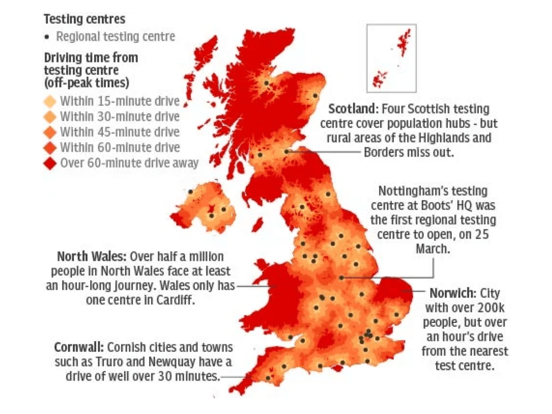
Create and combine many travel time polygons, then adjust the colour intensity to show a variable scale.
Customise your maps online by overlaying travel time polygons on top of map tiles.
Customise your maps online by overlaying travel time polygons on top of map tiles.

Use polygons and third party data to select the optimal location for your office, hospital, supply chain depot, outdoor advertising campaign etc. Combining travel time data with population data or other data sets will help you understand the best location for you.

Draw travel time polygon catchment areas to allocate sales territories. Increase efficiencies and reduce costs by helping people spend less time on the road, and more time with clients.

Travel time catchment areas are rarely a perfect circle. That’s because some areas within your polygon may be hard to access within the time limit. We call these accessibility blackspots Holes.

Your travel time catchment area may consist of more than one polygon. That’s just the nature of how transport networks are designed, sometimes you can get somewhere further away, even if you can’t access the places in between. Public transport islands often occur if there’s a fast train route and driving islands may highlight the location of a motorway exit.

After you request multiple isochrones, you can combine them into a single area.

After you request multiple isochrones, you can highlight the area that’s mutually reachable. For example, you can create a 30 minute catchment for 2 people living at different sides of the city. The mutual area shows where’s accessible for both people.

This indicates how detailed your isochrone polygons will look. If you want them to have smooth lines, choose a low number. If you’d prefer to see the exact area that’s accessible, it’s advised to choose a high granularity.
